More public access routes for Tatham
Lancashire County Council Regulatory Committee, at its last two (quarterly) meetings, considered two applications for Definitive Map Modification Orders in Tatham
Published: 17 April 2026
April 2026.
Lancashire County Council Regulatory Committee, at its last two (quarterly) meetings, considered two applications for Definitive Map Modification Orders in Tatham. Both “lost ways” claims were based on historical evidence for the existence of public access rights, and it seems likely that the routes were omitted – when paths were surveyed and added to the original map of public rights of way (PRoWs) in the early 1950s – because the routes were viewed by residents, landowners, and the parish councillors who did the survey, as roads rather than paths.
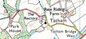
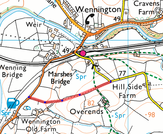
The two routes in question (see maps below) are
1. from Old Moor Road to the B6480 near the Bridge Inn;
2. from the road end in Low Tatham to Park House Farm.
The Committee accepted the recommendations of its officers that the applications be granted, and the routes added as Restricted Byways, a class of path that can be used by walkers, cyclists (including e-bikers), horse-riders, mobility scooters, powered wheelchairs, and horse-drawn vehicles, but not by any form of motorised vehicle. The head of the county PRoW team in his presentation said that the Park House route had almost certainly been at one time part of the main route from York to Lancaster depicted in the strip maps published in 1675 by John Ogilby.
Note that the routes will only be added to the rights of way map after a protracted (typically 18 months) legal process, at the end of which the Orders will be published and become effective.